Tuesday, March 31, 2009

Spring is here!!!

This is a jumping spider.


This is a honey bee.
This is the willow tree.
It is spring all right. The leaves on the trees are come out. The spring storms are here. and lots of bugs are out. There is a lot of flower at this place. And right now there is lots of them blooming. The lilac bushes are about to bloom. The Moon is in the evening sky now. Right now it looks like a big smile. But it does not have any eyes or any nose:( Good Bye for now!!!!

Monday, March 30, 2009

Snow:(

Well we did not get 2 to 5 inches like the NWS was forecasting:( Later they downed the snow accumulation to 1 inch. But we did not even get 1 inch:( All we got was a very light dusting on some grass and elevated surfaces. Maybe some time I will post some pictures of it.

Saturday, March 28, 2009

Update

Well, we have not gotten any snow yet:( But it did sleet for a bit. It will melt because it is above freezing. The NWS is still forecasting 2 to 5 inches of snow mainly for to night. Stay tuned for more updates!!!!

Friday, March 27, 2009

Snow!!!!

One to Four inches of snow are possible on Saturday( for us)!!! More snow would be possible (like four to eight inches)but warm ground temperatures and the high sun angle will limit the snow accumulation. Right now the Temperature is 36ºF and dropping. The NWS is forecasting 42ºF for a high today. So Maybe the rain will turn over to snow earlier then the NWS is forecasting?? Stay tuned for updates!!!

Monday, March 23, 2009

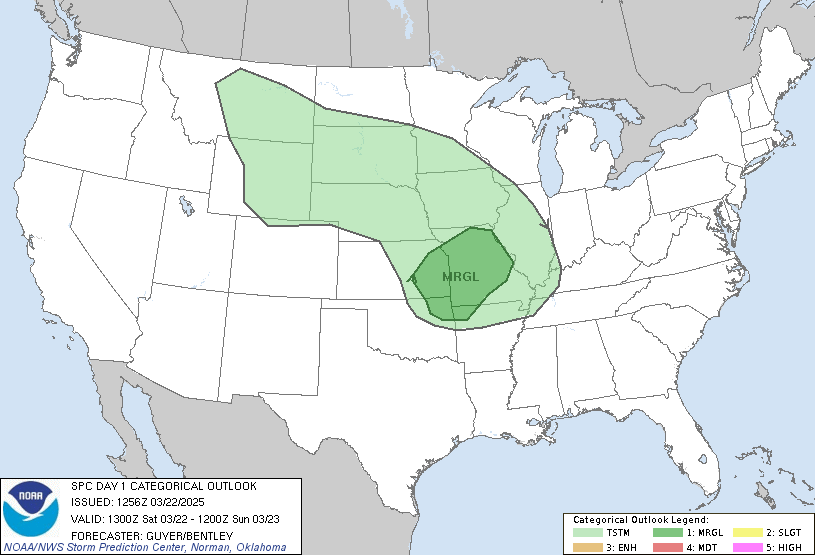
SEVERE THUNDERSTORMS

Severe thunderstorms are possible today and tonight.
HAZARDOUS WEATHER OUTLOOKNATIONAL WEATHER SERVICE SPRINGFIELD MO533 AM CDT MON MAR 23 2009KSZ073-097-101-MOZ055>058-066>071-077>083-088>098-101>106-241045-BOURBON-CRAWFORD-CHEROKEE-BENTON-MORGAN-MILLER-MARIES-VERNON-ST. CLAIR-HICKORY-CAMDEN-PULASKI-PHELPS-BARTON-CEDAR-POLK-DALLAS-LACLEDE-TEXAS-DENT-JASPER-DADE-GREENE-WEBSTER-WRIGHT-NEWTON-LAWRENCE-CHRISTIAN-DOUGLAS-HOWELL-SHANNON-MCDONALD-BARRY-STONE-TANEY-OZARK-OREGON-533 AM CDT MON MAR 23 2009...VERY STRONG WINDS TODAY...SEVERE THUNDERSTORMS POSSIBLETONIGHT INTO TUESDAY MORNING...THIS HAZARDOUS WEATHER OUTLOOK IS FOR PORTIONS OF THE MISSOURIOZARKS AND EXTREME SOUTHEAST KANSAS..DAY ONE...TODAY AND TONIGHT. WEATHER HAZARDS EXPECTED: HAIL TO THE SIZE OF QUARTERS THUNDERSTORM WIND GUSTS TO 60 MPH ISOLATED TORNADOES NON THUNDERSTORM WIND GUSTS TO 50 MPH AREAS AFFECTED AND TIMING: COMMUNITIES WEST OF A LINE FROM NEVADA TO JASPER TO POWELL FROM 9 PM THIS EVENING THROUGH EARLY TUESDAY MORNING. ADDITIONALLY NON THUNDERSTORM WIND GUSTS TO 50 MPH WILL BE POSSIBLE FOR SOUTHEAST KANSAS AND MISSOURI COMMUNITIES WEST OF A LINE FROM SHELL KNOB TO HARTVILLE TO SALEM FROM 7 AM THIS MORNING UNTIL 7 PM THIS EVENING DISCUSSION: WINDY CONDITIONS WILL PREVAIL TODAY AHEAD OF A DEVELOPING LOW PRESSURE SYSTEM OVER NORTHEAST COLORADO THIS MORNING. AS THE PRESSURE DIFFERENCE BETWEEN MISSOURI AND KANSAS CONTINUES TO INCREASE THIS MORNING...SOUTH TO SOUTHEAST WINDS WILL CONTINUE TO INCREASE. BY LATE MORNING...SOUTH WINDS OF 25 TO 35 MPH WITH GUSTS TO 50 MPH WILL BE COMMON FOR MANY COMMUNITIES. BY THIS AFTERNOON...SUPERCELL THUNDERSTORMS ARE EXPECTED TO DEVELOP OVER CENTRAL AND EASTERN KANSAS. AS THE EVENING PROGRESSES...A STRONG LOW LEVEL JET IS EXPECTED TO TURN MORE SOUTHWESTERLY AND AID IN THESE THUNDERSTORMS DEVELOPING IN EXTREME SOUTHEAST KANSAS AND WESTERN MISSOURI. THE STORMS ARE EXPECTED TO FORM INTO A WEAKENING SQUALL LINE AS IT MOVES INTO WESTERN MISSOURI. THE MAIN THREAT WITH THIS LINE WILL BE DAMAGING WINDS AND HAIL...BUT IF THE STORMS ARE ABLE TO SUSTAIN THEMSELVES...THEN A FEW TORNADOES COULD DEVELOP..DAYS TWO THROUGH SEVEN...TUESDAY THROUGH SUNDAY. BY TUESDAY MORNING...THE COLD FRONT THAT IS ASSOCIATED WITH THE SURFACE LOW WILL BEGIN TO MOVE INTO THE OZARKS. THUNDERSTORMS CAPABLE OF PRODUCING VERY HEAVY RAINFALL WILL DEVELOP ALONG AND JUST AHEAD OF THE COLD FRONT. AS UPPER LEVEL WIND BECOME MORE PARALLEL TO THE FRONT...TRAINING THUNDERSTORMS COULD DEVELOP RESULTING IN MULTIPLE THUNDERSTORMS TRAVERSING THE SAME AREA FOR AN EXTENDED PERIOD OF TIME. THIS COULD RESULT IN FLASH FLOODING OF SOME LOCATIONS..SPOTTER INFORMATION STATEMENT... SPOTTER ACTIVATION MAY BE NEEDED FOR COMMUNITIES WEST OF A LINE FROM POWELL TO JASPER TO NEVADA AFTER 9 PM THIS EVENING.&&THIS PRODUCT IS NOW AVAILABLE IN GRAPHICAL FORMAT...ALONG WITHOTHER WEATHER...HYDROLOGICAL AND CLIMATE INFORMATION...ATHTTP://WWW.CRH.NOAA.GOV/SGF(ALL LOWERCASE)$$CLAYCOMB

Sorry, I'm lazy so I put up the HAZARDOUS WEATHER OUTLOOK FROM THE NATIONAL WEATHER SERVICE SPRINGFIELD MO.

For more information Click Here to see updates from the SPC.

Thursday, March 19, 2009

Story.

John was leaning over the rail clutching Josh's two feet.
"What in the world are you doing?" gasped Chad.
"Josh is trying to get his hat he dropped over the rail," John hollered over his shoulder.
Just then John yelled, "Josh I'm losing my grip!"
Josh screamed and struggled for help.
"Stop kicking!" cried John. "I'm about ready to drop you!".
But Josh didn't stop struggling so John lost his grip and Josh plunged into the water with a splash. Chad, James and Jenny threw a live saver to Josh, and after a big struggle they pulled Josh to safety. All this time John stood stock still with apprehension.
At once, Josh was on deck. He went to take a long nap, But all of the others went to eat a big dinner.

THE END

Now this story is not as good as jenny's stories. I LOVE Jenny's stories.

Felix


Here is a picture of Felix in a trash can.
On March 26th the Moon will be a new Moon. Last night We had some thunderstorms. There was a lot of lighting, and the weather station said that we got 1/5 of an inch of rain. But more thunderstorms are possible early Next week through the middle part of next week. Some of the storms could become severe!! Of corse it is to far out to tell if the thunderstorms will become severe. Significant shear Should be in place and a good amount of moisture too. But instability is questionable. I will try to post updates about this weather event as it gets closer.

Friday, March 13, 2009

Snow Men Pictures.


Here are the snow men pictures.
This one is Buzz grins.
And this one is mine.
Space shuttle Discovery might be launched from the Kennedy Space Center on March 15th at 7:43 pm EDT.
For updates click here
Good Buy for now;)

Thursday, March 12, 2009

Limpin Hen Pictures


Here are the pictures of Limpin Len. She was so nice!! She had her wings over Old Red and Turken.
It was so funny!! and cute!!

Tuesday, March 10, 2009

Story

Here is part of my story. Anna(soup);) helped me to write it.

On a hot sunny day, a cruise ship is heading for the Caribbean. On board is a young man named Chad. He has thick black hair and brown eyes. He is tall and muscular and has medium brown skin.
Chad just woke up from a long nap and climbed up to the deck. He strolled past James and Jenny sleeping on a bench. He heard a loud commotion on the other side of the ship. He rushed to investigate. Chad's mouth dropped open at what he saw.


To be continued.

Monday, March 9, 2009

SEVERE THUNDERSTORMS

Severe thunderstorms are possible today and tonight!!!!!!!! The Storm Prediction Center has a Slight Risk for severe thunderstorms. Out for today and tonight.
Hail to the size of golf balls. damaging winds. and Super Cell thunder storms with isolated tornadoes. are all possilbe!!!!

Thursday, March 5, 2009

Snow Pictures

Here are the pictures of the snow!!!!!
Those are some big snow drifts that where about a half a mile from our house.


Here is a picture of Laser,Felix and Ringo.
They where in there becuse they did not want to
be out in the snow. Look at there faces!!!!!
Me and Ezra made "to" snow men. They had hair too!! Which were made out of sticks.But now all the snow is gone:(yesterday it was in the 60s.and today it could get in the 70s. To day there is a wind Advisory out. wind gusts up to 40mph.
The Moon is over half now. and you can see it in the evening. Severe thunderstorms might be possible Saturday night! Dad got a weather station For me and Ezra. It should come tomorrow.Well I got to go outside now so good bye.

Sunday, March 1, 2009

Squirrel

Ok here is the video.

He sure is cute.We where walking around in the woods and than we stumbled upon him( Eating his afternoon snack). He was no more than 15ft away!!! We got 4inches of snow!!!!!!!!!!!!! That is the most snow we have gotten this winter.I will post some pictures of it some time.